
Location Info
Bridge
Işıklar
The bridge is located at coordinates 38°25'27.65"N 27°14'0.20"E in Izmir – Bornova; Isikkent, Isiklar neighborhood, over Arap Deresi (Arab Creek). It is a main-arched bridge with slight slopes in both directions, featuring a total of two arches. The larger and higher opening, the main arch, indicates the main flow direction of the riverbed when the bridge was first constructed. A secondary arch supports flood water drainage...


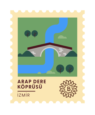
Arap Deresi Bridge
The bridge is located at coordinates 38°25'27.65"N 27°14'0.20"E in Izmir – Bornova; Isikkent, Isiklar neighborhood, over Arap Deresi (Arab Creek). It is a main-arched bridge with slight slopes in both directions, featuring a total of two arches. The larger and higher opening, the main arch, indicates the main flow direction of the riverbed when the bridge was first constructed. A secondary arch supports flood water drainage...
The bridge is located in İzmir – Bornova, Işıkkent, Işıklar neighbourhood, over Arap Deresi (Arab Creek), at coordinates 38°25'27.65"N 27°14'0.20"E.
It is a main-arch bridge with a slight gradient in both directions, comprising two arches in total. The larger and higher opening — the main arch — indicates the principal flow direction of the riverbed at the time of the bridge's original construction. The secondary arch, which serves to support flood-water drainage, also helps maintain a balanced gradient between the hillside and the bridge roadway. On the upstream face, between the two arches, stands a pointed architectural element known as a "selyaran" (cutwater), whose angled surfaces channel the river water into the arches, thereby preventing erosion of the central pier. On the downstream face of the central pier, the cuboid or circular spur (or heel) element commonly found on traditional stone bridges is absent here. It may have been destroyed over time, or may never have been deemed necessary.
The bridge's body walls are constructed of rubble stone, whilst the round-form arches are built with larger cut stones. Among the dressed and semi-dressed stones forming the arch courses, reused (spolia) blocks are also notable. The original road surface of the gently sloping deck appears to have been paved with river cobbles. The bridge's parapets have not survived to the present day.
Orientated in a south-west to north-east direction, the bridge, viewed in historical perspective, lies along the caravan route extending from the historic İzmir harbour and the commercial-cultural centres of Alsancak and Kemeraltı towards the hinterland. During the Ottoman period, caravans bound for the east are known to have assembled first at Pınarbaşı. Accordingly, convoys arriving from İzmir harbour, Alsancak and the Konak area to join the caravan would first have crossed the Kervan Bridge and then reached Pınarbaşı by way of the Arap Deresi Bridge. The presence of fountains on both sides of the bridge's route is consistent with a caravan thoroughfare.
The bridge bears no inscription, and no document relating to its date of construction has been found; however, its architectural characteristics and arch form suggest it may be attributed to the 18th–19th century.
According to oral-history studies conducted in connection with the Arap Deresi Bridge, camels were still being tethered to trees around the bridge as recently as forty years ago. During these studies, a well near the bridge — now no longer extant — was frequently mentioned. Villagers reported that the orchards and fields surrounding the bridge were irrigated by water drawn from this well up until some 40–45 years ago. They also recounted how, during the Greek occupation, the village of Işıklar was besieged but its inhabitants resisted and prevented its capture, and that the soldiers who fell in the fighting were cast into the same well — stories with which they had grown up.
Within the scope of this project, I wish to thank Dr Ender Özbay, Research Assistant at the Ege University Institute of Social Sciences, for his invaluable contributions on bridge terminology and the dating of the bridge's construction.
Ezel Kurmuş / Art Historian
References
- Işıklar, Salih Omurtak Cd., 35070 Bornova/İzmir
